
A front interacting with a coastal low will bring the chance for a plowable snow on Saturday. The front, diving down from Canada will be the leading edge of arctic air. Meanwhile a low pressure system is expected to develop off the coast of the Carolinas on Saturday morning. There are still some questions that need to be answered. How close does the low come to the coast and how fast will it move away? Will we see any mixing on the shoreline? Will this storm be cold enough and have the right ingredients for mesoscale banding?
My early call is 2"-4" for most of the state. If the low gets closer, there could be higher amounts in southern/eastern CT with some 4-6” amounts. We are right on the borderline of higher snowfall totals, which is why I’m so nervous One computer model, the NAM has KVPD (Providence, RI) getting a foot of snow! The others, have lower QPF and/or more mixing for RI/eastern MA. Just so you know, the Euro has been consistently showing 1”-3” for CT the past few days.
I have more confidence in the timing/impact of this storm. Snow arrives late Friday night (after 2 AM) and continues into Saturday afternoon. I never like to tell people to stay off the roads. That’s your choice. But I will tell you that roads will be snow covered and slippery during the day Saturday. As the storm pulls away, the winds will turn gusty and temps will tumble into the teen Saturday night (wind chills in the single digits). But roads should be plowed by Saturday night if you have plans.
One thought…Many of the models show a secondary low develop south of the coastal low. I wonder if that could and help steal energy and moisture away from us? Some of the 00Z model runs start coming in before the news starts at 10 PM. I hope that new data will bring more confidence in the forecast. I want to see less snow on the NAM. Not because I hate snow. But because it’s the outlier right now and I would love to see some models agree on the forecast!
Here’s a look at the GFS for Saturday afternoon. Notice the double barreled low with the bulk of precip staying offshore.
 The NAM has the same double barreled low but it’s closer to the shoreline bringing heavier precip onshore.
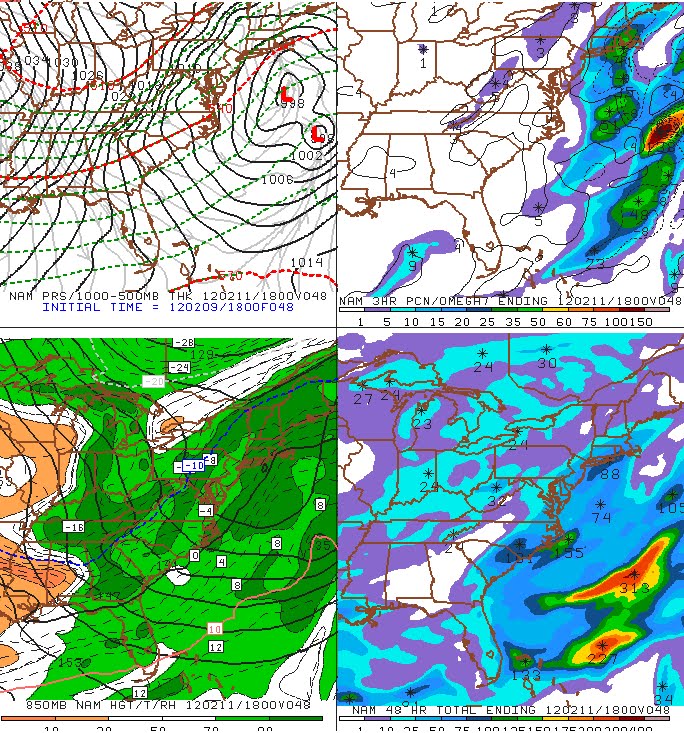
No comments:
Post a Comment