Create Your Own Wine, Beer And Soda At Cork And Brew
They’ve uncorked something new to Connecticut, a place where you can make your own wine, brew your own beer, and concoct your own soda. There is lots brewing on North Main Street in Southington at Cork & Brew where your inner vintner can come out.
I got to make a cameo in this story, without even knowing about it!

Friday, December 23, 2011
How To Perfectly Wrap Gifts
Well Erika learned how to professionally wrap. They just had me throw an old shirt over my gift. Somehow I managed to start singing in the middle of the interview. Typical. Watch here.
Thursday, December 22, 2011
Three Winters
There are three different definitions of winter.
Solar winter: November - January
is the quarter of the year with the lowest sun angle and shortest days.
Meteorological winter: December-January
is the coolest quarter of the year with the lowest average temperatures and the most snow and ice.
Astronomical winter: December 22-March 20
is the most familiar to you! Astronomical winter has to do with the earth position in relation to the sun. It begins during the winter solstice (when the sun is lowest in the sky) to the spring equinox (when the sun is directly over the equator).
So meteorological winter and solar winter are already over, that's 2/3. Not bad. 19 days to go and it will be spring on every calendar!
Wednesday, December 21, 2011
Winterizing Your Car
When it comes to tire traction, kitty litter is better than sand. Who knew?
Watch my live interview from Morning Extra here!
Watch my live interview from Morning Extra here!
Thursday, December 15, 2011
Champurrado (Mexican Hot Chocolate)
Watch Steve Yopp, executive chef of Besito make Champurrado, or Mexican hot chocolate! It was so good! The flavors are more complex than regular hot chocolate and it has a thicker consistency.
Ingredients:
4 cups Milk
½ cup Ground Mexican Chocolate ½ cup Dark Chocolate 1 stick Canela (Mexican Cinnamon) 3 tbsp Corn Masa ½ cup Sugar(Optional)
Steps to Make:
1. Heat the milk gently over medium heat, with cinnamon stick.
2. Stir in both types of chocolate, whisking constantly so it doesn't stick.
3. Once chocolate has melted, stir in the corn masa to desired thickness. Add sugar if desired.
Serving Suggestions:
1. Serve with warm churros.
2. Serve with peppermint stirring sticks.
3. Serve with bunuelos(crispy cinnamon sugar flour tortillas)
Dreaming Of A White X-Mas

Will we have a white Christmas? It's an age-old question that occurs to almost everyone this time of year. The National Climatic Data Center calculated the chance of a white Christmas by looking at a 30 year average from 1961-1990. I think their results are too high for Bridgeport and Hartford.
Hartford
57% chance of an inch on the ground
27% chance of 3"
3% chance of 10"
Bridgeport
30% chance of an inch on the ground
10% chance of 3"
0% chance of 10"
A 50/50 shot at a white Christmas in Hartford? And Bridgeport is white 3 out of 10 years? Hmmm...that doesn't seem right. Maybe the sample years were too cold. When I ran some calculations using weatherspark.com, I got a 25% chance of a white Christmas in Hartford. That makes more sense. And Bridgeport has an 11% chance of at least some snow on the ground. Either way, it's not looking too good for us this year with no arctic air in sight. We could see a little snow next Wednesday in the higher elevations, but right now it doesn't look like enough to coat the ground. At this point we'll take what we can get!
Sunday, December 11, 2011
Last Wed/Thu: Rain, Wind, & A Touch Of Snow
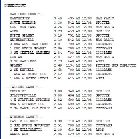
Little or no snow fell in Hartford and points south and east. I did think we would get more accumuation in the Litchfield hils. But the cold air didn't come in fast enough! Still, there were plenty of school delays in the higher elevations where it looked like a winter wonderland for a little while.
This was more of a rain and wind storm than anything else. A peak wind gust of 56 mph was reported in New London! There were scattered power outages all over the state!
Snow totals:
Norfolk: 2.8"
Tolland: 1.0"
Staffordville: 1.0"
Coventry: 0.5"
Stafford Springs: 0.3"
Bakersville: 0.3"
Rain Totals:


This was more of a rain and wind storm than anything else. A peak wind gust of 56 mph was reported in New London! There were scattered power outages all over the state!
Snow totals:
Norfolk: 2.8"
Tolland: 1.0"
Staffordville: 1.0"
Coventry: 0.5"
Stafford Springs: 0.3"
Bakersville: 0.3"
Rain Totals:

Friday, December 9, 2011
Wettest Year On Record!
Pat yourself on the back. We deserve some recognition after the wet year we survived! It all started with record breaking snowfall in January, then it was remnants of tropical storm Lee, tropical storm Irene, an October Nor'easter and lastly a rainy Tuesday/Wednesday.
Now 2011 will go down in the record books as....
THE WETTEST YEAR ON RECORD!!
2011: 66.97"
Previous record (2008): 65.42
Records for Windsor Locks date back to 1905. And the year is not over yet!
Now 2011 will go down in the record books as....
THE WETTEST YEAR ON RECORD!!
2011: 66.97"
Previous record (2008): 65.42
Records for Windsor Locks date back to 1905. And the year is not over yet!
Wednesday, December 7, 2011
More Wet Than White
I have adjusted snowfall accumulations down a smidge. Little or no accumulation for areas south and east of Hartford. A slushy coating to an inch everywhere else. The exception will be northern Litchfield County which can still pick up 2"-5" of wet snow. Here is the 9Z NAM. I like it better than the 12Z which looks a little too cold. Ski/Snowboard areas in MA/VT/NH could get anywhere from 3"-12" of snow. The changeover to snow will occur too late for plowable snow for the vast majority of CT. Rain is the bigger issue here. As of today, this is the 2nd wettest year on record for Windsor Locks and we only need a half inch to make it to the #1 spot. Will we make it? I would take that bet considering the models have another 1"-2" of rain falling tonight! A flood watch is issued for all of CT. Minor flooding is possible for small streams, creeks, low lying areas and poor drainage areas.

The storm is out of here around sunrise tomorrow. The rest of the day will be breezy and cooler with temps in the 40s and gusts up to 30 mph. Look for a chill to settle in this weekend with highs in the 30s. Look at the calendar before you complain. ;)
 Rain is the bigger issue here. As of today, this is the 2nd wettest year on record for Windsor Locks and we only need a half inch to make it to the #1 spot. Will we make it? I would take that bet considering the models have another 1"-2" of rain falling tonight! A flood watch is issued for all of CT. Minor flooding is possible for small streams, creeks, low lying areas and poor drainage areas.
The storm is out of here around sunrise tomorrow. The rest of the day will be breezy and cooler with temps in the 40s and gusts up to 30 mph. Look for a chill to settle in this weekend with highs in the 30s. Look at the calendar before you complain. ;)
Tuesday, December 6, 2011
From Warm To Wet To...White??
 WOW! 50s again today!? No wonder no one believes me when I tell them it’s December! The cold front preceding cold air to our west has stalled. That means we have one more mild, showery day before temperatures tumble.
Tonight: mild with shower and patchy fog. Low: 45-50.
Keep in mind, the low temperature tonight is above the average high temperature for this time of year!
Tomorrow: Times of rain, mild: High 50-55.
The heaviest rain falls tomorrow night when a low developing on the stalled front moves off the NJ coast. Although the storm looks stronger, it also looks a milder than previous model runs. Rain will mix in or change over to wet snow at the very last minute Thursday morning. Shoreline and valley locations will get little or no snow accumulation and the higher elevations of ct could pick up a slushy inch or two. The exception will be the hills of Litchfield county where 3”-6” of snow is possible, with higher amounts along the Massachusetts border. I expect a changeover to snow after 2 AM in these locations.
The storm is completely gone by 9 am Thursday with the wind picking up and falling temperatures. Overall…the changeover to snow has bad timing because some people will be on the road, but for most of the state this is a non event or a nuisance event. Western Massachusetts and Litchfield County will have more “fun” with a nice plowable snow. Let’s just hope it’s not another power outage maker.
Liquid equivalents will range between 1”-2”! We are only 1.2” away from the wettest year on record in Windsor Locks. I think this storm will put us over the edge helping up achieve that record. After all we’ve been through this year, we deserve it!
Friday, December 2, 2011
December Preview
My new addiction is weatherspark.com. The site takes boring weather stats and turns them into easy-to-read (pretty) weather charts and graphs.
The month of December is characterized by falling daily high temperatures (thank you captain obvious). Daily high temps decreasing from 46°F to 38°F over the course of the month. Daily low temperatures range from 24°F to 31°F.
Daily High and Low Temperature in December The daily average low (blue) and high (red) temperature with percentile bands (inner band from 25th to 75th percentile, outer band from 10th to 90th percentile).
 The likelihood of snow falling is highest around December 31, occurring in 28% of days.
The month of December is characterized by falling daily high temperatures (thank you captain obvious). Daily high temps decreasing from 46°F to 38°F over the course of the month. Daily low temperatures range from 24°F to 31°F.
Daily High and Low Temperature in December
The daily average low (blue) and high (red) temperature with percentile bands (inner band from 25th to 75th percentile, outer band from 10th to 90th percentile). Fraction of Time Spent in Various Temperature Bands in December The average fraction of time spent in various temperature bands: frigid (below 15°F), freezing (15°F to 32°F), cold (32°F to 50°F), cool (50°F to 65°F). Notice the average amount of time we spend below freezing increases throughout the month.
Types of Precipitation Throughout December Relative frequency of various types of precipitation over the course of a typical December.
Light rain is the most severe precipitation observed during 29% of those days with precipitation. It is most likely around December 1, when it is observed during 17% of all days.
Light snow is the most severe precipitation observed during 28% of those days with precipitation. It is most likely around December 31, when it is observed during 18% of all days.
Moderate rain is the most severe precipitation observed during 16% of those days with precipitation. It is most likely around December 2, when it is observed during 9% of all days.
Moderate snow is the most severe precipitation observed during 12% of those days with precipitation. It is most likely around December 31, when it is observed during 8% of all days.
Probability of Snow Fall Being Reported in a Given Day in December
 The likelihood of snow falling is highest around December 31, occurring in 28% of days.
November Summary: Mild & Sunny!
November is notoriously cloudy. According to weatherspark.com, a website that collects and charts climate data, November is “cloudy” or “mostly cloudy” 55% of the time. See below.
 Not this year. This year the sky was cloudy only 30% of the time with 21 days spent partly cloudy or clear conditions.
This November was also very mild with an average high temperature of 57.2 degrees. We had 13 days in the 60s. And the average temperature was 4 degrees above average!
Precipitation was right around average with 3.81”. But the rain was concentrated with only five days recording over 0.03” of rain. So most of the month was dry!
This doesn’t mean anything about how we will spend our winter. A mild November doesn’t mean a mild December. In fact, sometimes Mother Nature usually finds a way to make sure everything balances out in the end.
Winter Is Here....Huh?
Welcome to winter! Huh? I know, I know. Your calendar says winter starts December 22nd when the sun’s rays shine over the tropic of Capricorn. That’s astronomical winter. But in meteorology, we like to keep things simple.
The coldest quarter of the year is December through February. So we call those three months, meteorological winter. So here we go snow lovers….it’s only a matter of time before I’m ripping out my hair forecasting our next snow storm. In the short term, I don’t see much cool air until the end of next week.
The coldest quarter of the year is December through February. So we call those three months, meteorological winter. So here we go snow lovers….it’s only a matter of time before I’m ripping out my hair forecasting our next snow storm. In the short term, I don’t see much cool air until the end of next week.
Wednesday, November 30, 2011
2011 Atlantic Hurricane Season Ends Today
Here is a graphic I made showing the number of named storms, hurricanes and major hurricanes this year. Let's not lie...there's only one hurricane that truly mattered to us this year. Hopefully another decade goes by before I say that again!
 2011 Season Highlights
 2011 Season Highlights
 - This level of activity matched NOAA’s predictions and continues the trend of active hurricane seasons that began in 1995.
- The 19 tropical storms represent the third-highest total (tied with 1887, 1995, and 2010) since records began in 1851 and is well above the average of 11.
- However, the number of hurricanes and major hurricanes is only slightly above the average of six and two.
- Irene was the lone hurricane to hit the United States in 2011, and the first one to do so since Ike struck southeast Texas in 2008.
- 2011 marks a record six straight years without a major hurricane hitting the United States. The last one to do so was Wilma in 2005.
Third Wettest Year On Record!
Another inch of rain last night helped us climb from the #4 to #3 spot. In over one hundred years of record keeping, this is the third wettest for Windsor Locks.
Since January 1st: 64.22"
#1 Wettest Year: 65.42" (2008)
We need 1.2" of rain to break the record. With an entire month lelft to collect, it's almost certain we get there. And I hope I never have to talk about breaking the record again!
Since January 1st: 64.22"
#1 Wettest Year: 65.42" (2008)
We need 1.2" of rain to break the record. With an entire month lelft to collect, it's almost certain we get there. And I hope I never have to talk about breaking the record again!
Tuesday, November 29, 2011
Record Warmth! Where's The Chill?
Windsor Locks set a new record high today of 66 degrees. This shatters the old record of 63 degrees set back in 2005.
It's November? REALLY!?
Cooler air will slowly leak into Connecticut by this weekend when the calendar reads "December". The cooler air will arrive behind a front bringing heavy rain at times tonight. Temperatures will stay in the 50s tomorrow. By this weekend 40s are in the forecast. But there is no true COLD or arctic air in sight. Sorry snow bunnies. There could be some hope at the end of NEXT week.
Toys For Tots
 On black friday I had the pleasure of going to the dreaded mall. (Cue scary music)
Actually...the Meriden Mall had surprisingly normal crowds. I was secretly hoping to see some elbow throwing (while watching from a safe distace).
But I digress...Nothing was going to keep me from the mall because I was there to help the Marine Corps collect Toys For Tots. The programs has collected 400 million toys over the years. This year their goal is 17,000 toys for needy CT families.
I was joined by the talented and lovely 102.9 WDRC-FM. We will be teaming up at several toy drives this holiday season (including one on Friday). Please come by, say hi, and drop off a toy!
Monday, November 28, 2011
Manchester Road Race
I had a blast covering the 75th annual Manchester Road Race. Sure, working Thanksgiving is never really ideal. But does watching a race surrounded by people dressed up in rejected Halloween costumes count as work?
Here is the highlight of my TV career:
 Hanging with Joe Furey on the way to the race! Yes, I'm wearing drumsticks on my head. And no, I didn't take them off during on-air coverage of the race.
 Betty Hutchinson set the 90-plus women's record in 2010 with a time of 1 hour, 17 minutes, 31 seconds. Hutchinson ran again this year at age 91.
 Julia Chase-Brand honored at the 75th annual Manchester Road Race. In 1961, Chase-Brand, then a 19-year-old from Groton, defied powerful Amateur Athletic Union officials and became the first woman to run the 4.78-mile road race at a time when women were banned from such events.
 AND THEY'RE OFF!

Really? That's a costume? REALLY!? And what are you doing lady!?
 Behind the scenes with the FOX CT crew!
Here is the highlight of my TV career:
Some pics I snapped during coverage:
 Hanging with Joe Furey on the way to the race! Yes, I'm wearing drumsticks on my head. And no, I didn't take them off during on-air coverage of the race.
 Betty Hutchinson set the 90-plus women's record in 2010 with a time of 1 hour, 17 minutes, 31 seconds. Hutchinson ran again this year at age 91.
 Julia Chase-Brand honored at the 75th annual Manchester Road Race. In 1961, Chase-Brand, then a 19-year-old from Groton, defied powerful Amateur Athletic Union officials and became the first woman to run the 4.78-mile road race at a time when women were banned from such events.
  AND THEY'RE OFF!
Really? That's a costume? REALLY!? And what are you doing lady!?
 Behind the scenes with the FOX CT crew!
Tuesday, November 22, 2011
Heavy Rain & Wind Wednesday, Snow Bunnies Look North
Tomorrow morning will be nasty for the commute with heavy rain and gusty winds. Prepare for traffic. People don’t know how to drive in the rain (aint it the truth)!
The heaviest rain is expected after midnight tonight through 10 AM tomorrow (Wednesday). Rain will taper off throughout the afternoon to scattered showers. So if you have plans to drive tomorrow, the later, the better! 1”-3” of rain is expected making the ground soggy. Winds will gust up to 25 mph inland, 35 mph along the shoreline which will cause some additional outages (especially with all the hanging branches left from our October nor’easter).
ATTENTION SKIERS AND SNOWBOARDERS! Mother Nature is giving you an early Christmas present! Parts of Vermont, Maine and New Hampshire are in for a major snow storm with anywhere from a few inches to up over a foot of snow! Unfortunately this also means those of you traveling up north or expecting friends from the north will experience major travel issues.
Here’s the European model’s (ECMWF) snow forecast. Thanksgiving is always an iffy time of year. It can be sunny and warm or snowy and cold!

Monday, November 21, 2011
Thanksgiving Travelcast!

You will have no problem traveling during the day tomorrow. Rain will move in tomorrow (Tuesday) night with the heaviest between midnight Wednesday to noon Wednesday. 1"-2" of rain is forecast during one of the biggest travel days of the year. Ouch. Hey, at least it's not snow! Skiers and snowboarders should head to northern New England where it's cold enough for a few inches of snow in Vermont and New Hampshire. Plus a lot of mountains are already making snow!
Thanksgiving will feature clearing with temps in the upper 40s. Wear layers for the Manchester Road Race with temps starting in the upper 30s and a cool breeze!
Sunday, November 20, 2011
Rainy Travel Day Wednesday. Please stop worrying about a snowstorm.
“How are you ignoring this possible storm Tues/Wed next week....isn't there a shot for snow??”
This is a tweet I received on Friday and I continue to hear messages about a potential snow storm for Wednesday. I’m not sure who was sounding the alarm on this one…but it wasn’t anyone I work with!
A storm moving in on Tuesday night into Wednesday will take a northerly track through central New York, Vermont and New Hampshire putting us in the “warm sector” of the storm. (See diagram below for a typical midlatitide cyclone.) Winds will blow out of the southwest funneling in milder air and keeping temps in the 50s and our precip as rain.
 Rain will come down heavy at times Wednesday (adding 1"-2" to what is already the 5th wettest year on record). As the storm pulls away Wednesday night winds will shift out of the northwest (see diagram above again). Now the question is…will the rain move out before the cold air gets here? OR will the cold air rush in changing the rain over to a wintry mix?
The model consensus is that rain moves out before the bulk of the cold air gets here. However, I wouldn’t be surprised if some of the lingering showers Wednesday night mix in with a little wet snow above 1000 feet. Either way, rain is the main concern Wednesday as you head off to see friends and family for Thanksgiving. And Thanksgiving Day looks lovely with sunny skies and temps in the mid 40s.
NERD ALERT: This is why I’m not concerned about accumulating snow Wednesday
Below you’ll find the latest European model run for Wednesday at 1 PM. The colored shading represents QPF (quantitative precipitation forecasts) or in this case, 6 hour rainfall amounts. The dashed lines show 1000 -500 mb thickness. The thickness represents the distance between the 1000 and 500 mb pressure levels. The distance is mainly a function temperature. The greater the thickness, the warmer the air (because warm air takes up more volume than cold air. That’s why you need to add air to your tires when it gets cold.)
 Notice how all the dashed lines are blue except the one marked “540”. That’s because the 540 line is often used to approximate the rain/snow line. This isn’t always the case but it’s a rough estimate. Notice the 540 line is well north of CT with rain falling across almost all of New England.
Now below you'll find the Euro (or ECMWF) at 7 PM. Now the 540 line has moved south of western Massachusetts and Vermont where rain is changing over to snow. The 540 is just west of CT. But by this time, most of the precipitation has already moved out. This is where we could see some wet snowflakes begin to mix in for the highest elevations.
 But when the coldest air invades and the 540 line drops south of CT, all the precipitation has already moved out. See the Euro at 1 AM Thursday below.
 Here’s the European’s snowfall forecast with accumulating snow in parts of MA up through northern New England where they spent more time in the cold sector of the storm. I’ll let you know if anything changes. But for now, rain is the main type of precip and for most of the state the only precip type on Wednesday.
This is a tweet I received on Friday and I continue to hear messages about a potential snow storm for Wednesday. I’m not sure who was sounding the alarm on this one…but it wasn’t anyone I work with!
A storm moving in on Tuesday night into Wednesday will take a northerly track through central New York, Vermont and New Hampshire putting us in the “warm sector” of the storm. (See diagram below for a typical midlatitide cyclone.) Winds will blow out of the southwest funneling in milder air and keeping temps in the 50s and our precip as rain.
 Rain will come down heavy at times Wednesday (adding 1"-2" to what is already the 5th wettest year on record). As the storm pulls away Wednesday night winds will shift out of the northwest (see diagram above again). Now the question is…will the rain move out before the cold air gets here? OR will the cold air rush in changing the rain over to a wintry mix?
The model consensus is that rain moves out before the bulk of the cold air gets here. However, I wouldn’t be surprised if some of the lingering showers Wednesday night mix in with a little wet snow above 1000 feet. Either way, rain is the main concern Wednesday as you head off to see friends and family for Thanksgiving. And Thanksgiving Day looks lovely with sunny skies and temps in the mid 40s.
NERD ALERT: This is why I’m not concerned about accumulating snow Wednesday
Below you’ll find the latest European model run for Wednesday at 1 PM. The colored shading represents QPF (quantitative precipitation forecasts) or in this case, 6 hour rainfall amounts. The dashed lines show 1000 -500 mb thickness. The thickness represents the distance between the 1000 and 500 mb pressure levels. The distance is mainly a function temperature. The greater the thickness, the warmer the air (because warm air takes up more volume than cold air. That’s why you need to add air to your tires when it gets cold.)

Now below you'll find the Euro (or ECMWF) at 7 PM. Now the 540 line has moved south of western Massachusetts and Vermont where rain is changing over to snow. The 540 is just west of CT. But by this time, most of the precipitation has already moved out. This is where we could see some wet snowflakes begin to mix in for the highest elevations.


Wednesday, November 16, 2011
5th Wettest Year On Record!
 The NWS will double check the numbers. But according to my calculations, 2011 is now the 5th wettest year on record for Windsor Locks with 61.15" (as of 4pm Wednesday). We need less than half an inch to climb up to the #4 spot.
To shatter all records and climb to #1, we need to see 4.28" or precipitation between now and December 31. I think we have a pretty good shot! Records date back to 1905.
At least we are getting some recognition for dealing with all the heavy rain from Irene and the remnants of Lee.
Tuesday, November 15, 2011
Baby Foxes On FOX!
 Today on Morning Extra(weekdays 9-10) I got to hold a fennec fox from the children's museum. It was the highlight of my morning show career! Check out their ears! AND they're fully grown! I want one. Plus, my cats are bigger than they are so there shouldn't be a problem.
Click here to watch the video!
From Warm & Unsettled To Cooler and Dry
One thing I hate about working mornings: walking out the door only to face the coldest temperatures of the day. I have a hard enough time getting out the door as it is.
But this morning was a treat! Temperatures starting in the 50s in NOVEMBER? The average low temperature is in the 30s. Right now it’s 66 in Willimatic, at 11:00 AM! We’re getting spoiled!
So where IS the cold air? Very close. A stalled cold front wobbling around New England is the boundary between mild air to the south and cold air to the north. That front is also the trigger for scattered showers today and a period of rain tomorrow.
But our spring fling will come to an end as a second cold front ushers in drier, cooler air for the end of the week (Thursday and Friday). Although the weather after this front will be cooler, I don’t see any arctic air for the next two weeks! And after our October nor’easter, I’m ok with that!
Thursday, November 10, 2011
Kicking Off The Holidays At Westfarms
 Tonight I helped kick start the holidays at Westfarms mall. Yeah, yeah I know it's not even Thanksgiving yet.
Westfarms mall unveiled their new Ice Palace AND the winner of "The Voice", Javier Colon performed some holiday songs and his new single, "As Long As We Got Love".
There was a huge turn out, I was shocked! Javier is from West Hartford so he has a lot of love and support here in Connecticut. By the way, being on television doesn't prepare you for public speaking. When you can actually SEE all those people staring back at you....woah. I still get a little adrenaline rush thinking about it.

Pic Courtesy of West Hartford Patch
FOX CT reporter Jeevan Vittal was reporting at the mall, and since he was a good boy this year I shared Santa with him! Clearly, Santa was more interested in the photographer.

Joe Furey's TWO Surprise Birthday Parties
 Joe Furey is one of my favorite people in the world. He’s a great friend, a loving Dad and one hell of a meteorologist! Sometimes he calls just to say hi and we end up talking for an hour! He calls me his fifth daughter.
Joe’s wife Tracy (who works for WFSB) wanted to plan a surprise party for his birthday at the New England Air Museum. She asked if I would help make a guest list and hand out invitations at FOX. (Obviously it would look suspicious if she showed up at work.)
I had one job…and I blew it. Somehow Joe found the envelope with a WFSB logo in the corner and his wife’s handwriting on it. Of course he started asking questions. So Tracy and I had to think fast. “We’ll have a fake surprise party on his birthday, five days before the real party!” Tracy even made fake surprise party invitations in case Joe went snooping around for more clues.
Well on his birthday, Joe was cranky. After the nor’easter everyone was tired and unshowered. “Joe, let’s have a birthday breakfast!” I chirped on November 1st. Joe is always happy and sweet. Not today.
“Why? I’m not hungry. And I hate surprises. Plus I’m tired,” Joe whined. Oy. Well I finally dragged him out to breakfast and, voila! We had surprise party number one with about 30 people.
Joe bought it.
The real party happened that Friday. Bruce DePriest (Joe’s best friend) wrote Joe a letter pretending to be a “Flying Club” meeting at the New England Air Museum and they invited him to speak! As the date approached, Joe kept wondering why it wasn’t canceled in lieu of the recent storm. The party set-up was fantastic! Tracy did an amazing job. Tables for the party were surrounded by antique airplanes.
“Shhhh….Joe’s here!” The roar of close to a hundred people came to a halt.
“SURPRISE!!!” Well…Joe looked like he saw a ghost.

Joe later told me he thought he died and was seeing his friends and family on the way to heaven. It was a great party and an interesting guest list. Joe has worked for many radio stations and TV stations in the state (we’re a very incestuous industry). So radio legends and TV anchors/meteorologists were strolling around mingling instead of competing for ratings.
We took a group shot of all the meteorologists there. I’m at least a foot shorter than all of them.
 Testing the wind speed in the air museum. This is how the pros do it!
 Joe got the very best in forecasting technology as a gift...a weather dartboard!
 It was a really fun event and I know Joe had a great time! HAPPY BIRTHDAY buddy! I think Joe likes surprises now!
Here are some pics from Geoff Fox's camera:
Tuesday, November 8, 2011
A blog post I wrote in the storm without power. Seems so long ago now...
October 29th, 3:00 PM.
Yes, home at last to track a storm from my couch! I just finished a ten hour workday and was settling in for a night of storm tracking. It’s so rare for me to be home to actually enjoy a snow storm. Yes, I realize how ridiculous that must sound to some of you. But while I’m at work on storm coverage, I’m stressed out. I am constantly hitting the refresh button checking for the latest storm damage, accumulations, radar imagery, new computer model data, updating the forecast, broadcasting updates, making weather graphics and updating my colleagues in the field. It’s non stop.
While I’m home, I’m still technically working. I still do all the stuff I just mentioned, but I have more time to digest everything. It’s no longer a race. I am no longer confined to a dark TV studio. I get to look out the window. I am finally reminded by the reason I got into this job…because I love the weather. It never fails to surprise me. An October nor’easter? I’m excited to witness such a rare and historic event.
4:00 PM Thundersnow!
With a large pressure drop accompanying the storm and strong upward motion, the atmosphere was very unstable. Think of it like a winter thunderstorm. I hear other sounds too. Every few minutes I hear the cracking sound of nearby trees struggling to hold the weight of the heavy snow. This wet snow has a low snow to liquid ratio. That means it holds more water than the white fluffy powder that skiers dream about. The more water the snow holds, the heavier it is. And this snow is about the heaviest I’ve ever seen.
4:30 PM
So I’m about to hit “publish” on a blog post about power outages and the dangers of driving while snow iced trees fall like missles. 260,000 were without power and the storm wasn’t over. Not even close. Then it happened. MY power went out. NO! Well at least I have a laptop. Wait a minute…I quickly checked and refreshed my internet connection as if it somehow worked on batteries. Turns out it didn’t. This reminded me of a Twilight Zone episode. A librarian survives a nuclear attack with millions of books, then he breaks his glasses leaving him unable to read.
I grabbed my blackberry. One battery bar left. How could I be so stupid? Here I am telling people for days to prepare for power outages and I haven’t done a thing. I pulled up the radar. It took nearly a minute to load. Why didn’t I get an iPhone? I tried my usual weather sites but they weren’t compatible on my phone which was about to die.
I called Geoff Fox. “What do I do?” I know I sounded desperate. I could tell he felt bad for me. “You can come to work and play with your friends,” Geoff suggested. “Do you want me to pick you up? You really should stay home, it’s dangerous outside.” I looked up at the blog post I never got to publish, warning people to stay home. He was right. Now what? I ran down to my car to charge my phone then lit about 30 tea light candles. It was a romantic evening with me and the boys…my two cats and turtle. As the heat seeped out through the cracks in the windows, I curled up into a ball with my heaviest blanket and a book on ipad. Well, I guess I got my wish. I was able to enjoy a snow storm without working. But it turns out…I wished I was at work the entire time.
Wednesday, November 2, 2011
Storm Frustration Shifts To Lack Of Out-Of-State Crews
According to the Courant, the same out of state power crews that helped after Irene will NOT come back this time because they haven't been paid. REALLY? 99% of the state is supposed to have power back by Sunday. I find that hard to believe.
You can read the article here
You can read the article here
Monday, October 31, 2011
Snowtober: Cleaning Up After The Historic October Nor'easter
 The October Nor’easter was the storm of a lifetime. Really. Many of you will not see destruction like this from a snowstorm for the rest of your lives. And now all you ghosts, goblins and Lady Gagas will be trick or treating for the first time on plowed driveways. That is…if your town doesn’t cancel the holiday festivities.
Why was it so bad?
If this storm happened two weeks later, we would have half the problems. With leaves covering the trees, the heavy wet snow had an extra place to stick to. The snow had a very low snow to liquid ratio which means it had more water and more weight than the powdery fluffy stuff skiers dream about. That meant more weight on trees and power lines. Tropical storm force wind gusts proved the final ingredient for chaos.

The result? The most widespread power outage in the state’s history, topping Tropical Storm Irene earlier this year! At one point 884,000 customers were in the dark! (Pretty much all of CL&P customers north of I-84.) The electric company is warns that people could be out of power for a week. But I think some rural areas may be forced to wait longer than that!

Interesting Factors
Temperatures remained above freezing for the entire event! I was shocked by how easily the sludge accumulated on the ground! I also thought we would see a longer period of rain before the changeover to snow. But the initial batch of precipitation was so heavy that it cooled the atmosphere enough for snow right off the bat! We call this evaporational cooling. We also experienced dynamic cooling during the event which is the cooling of the atmosphere caused by the big drop in pressure in the storm. The same drop in pressure and associated rising motion caused instability resulting in thundersnow, a rare occurrence.
Accumulations
Western Connecticut got pounded with 12”-20” of snow. Many of us meteorologists are confused by the number reported by Bradley International Airport. 20.1”? Not likely when you look at nearby Enfield. Before midnight BDL reported 12.1” which makes more sense. Either way, I think we broke the previous record of 1.7”! The shoreline got 3”-6” with the immediate shoreline getting the lower end of the scale. Some in the far southeastern corner of Connecticut which remained a messy mix of rain and snow reported a couple slushy inches.
Click the image to enlarge NWS snow totals:

1"-17" In Historic October Storm
Snow Totals:
Litchfield County
Fairfield, Middlesex, New Haven Counties
Hartford, Tolland, Windham Counties
I'll have time to talk more about this later! For now I have to get ready for FOX CT Morning Extra.
Litchfield County
Fairfield, Middlesex, New Haven Counties
Hartford, Tolland, Windham Counties
I'll have time to talk more about this later! For now I have to get ready for FOX CT Morning Extra.
Saturday, October 29, 2011
Dangerous Outside
I was about to hit "publish" on this post right before the power went out.
I don't use the word dangerous very often. Over 325,000 people (including me) are now without power. Thats is 25% of CL&P's consumers. Trees, branches and powerlines are falling all across the state & the worst of the storm hasn't even hit yet.
This is a very heavy wet snow with a low snow to liquid ratio, meaning it's heavier than the powdery stuff, weighing everything down. The snow is sticking to the roads easily.
The Merritt Parkway is now closed to non emergency traffic. I-84 in Southington is closed. Numerous crashes and bumper-to-bumper traffic forced police to shut down Route 44 on both sides of Avon Mountain in West Hartford and Avon.
Danbury's Mayor, Mark Boughton, ordered all local roads shut down by 4 p.m. The Mayor said only emergency vehicles would be allowed in order to clear away cars that are stuck.
I heard thunder at my house a few hours ago. Thundersnow is very rare! Think of a winter thunderstorm. With strong upward motion our air is very unstable. Snowfall rates will increase to 1"-2" per hour at times tonight. The forecast is still on track! This will be my last blog post. My blackberry doesn't have very good radar and I had to have my Mom publish this post.
Mom says, "If you still have power, find your flashlights, batteries and candles now!"
Be safe!
New Haven Green Is WHITE!

Hmmmm....I thought the NAM (computer model) was too cold. But we are changing over to snow way too quickly along the shoreline. This could mean more snow for New Haven, Bridgeport. I initially had the shore in the 6"-10" range but bumped them down to 3"-6" because I anticipated more mixing. (Read blog post below) I'll keep an eye on things and let you know if I need to go back to my original thinking! This storm is still evolving. FYI...the NAM forecasted 9" of snow in Bridegort and New Haven, 5.4" in Groton.
It Has Begun

Check out the heavy sleet band heading for the shoreline. Many areas in southern Connecticut now reporting light snow. Heavy snow is falling in Greenwich and Stamford right now with light rain in New London.
Game On!

This morning is the time to run your errands! The weather will deteriorate throughout the afternoon and tonight.
The overnight models haven’t changed much. I’m comfortable with 6”-12” inland. But the shoreline/SE CT is a much harder forecast with the opportunity for more rain to mix in. I will need to closely monitor everything throughout the day and “nowcast” as they call it.
Don’t be surprised if some of you southeast of Hartford don’t see snow until after sunset. That doesn’t mean you’re out of the woods. Heavy wet snow will accumulate quickly and the worst is still expected after sunset.
For more on timing and what to expect please read my previous post!
Friday, October 28, 2011
Historic October Snow Storm
The biggest October storm in recent history was October 4, 1987. But this event was primarily in western Connecticut. Norfolk recorded 9.5” of snow. But Hartford got a little coating (trace).
The most snow ever recorded in October for greater Hartford is 1.7” on October 10, 1979. All we need Saturday is to 2” to break the record and I think we will triple that number!
Timing:
The storm will arrive midday between 10AM-1 PM as a rain/wintry mix. But that mix will change over to a heavy wet snow from northwest to southeast throughout the afternoon. Snow will pick up in intensity later in the afternoon with the worst starting around or just after 4 PM. Snow will come down heavy at times. In fact, I wouldn’t be surprised if you heard thunder tomorrow night. Yep, thundersnow is possible! If that happens, snowfall rates could get up to 1”-2” per hour with blizzard conditions. The snow winds down and ends just before sunrise on Sunday.
Amounts:

I’m forecasting 6”-10” across most of the state. Areas in northwestern Connecticut, especially in the higher elevations, could pick up a foot of snow! Litchfield County, I’m talking to you! Right now I’m including New Haven and Bridgeport in that 6”-10” range. It makes me nervous because the shoreline almost always has more mixing due to the proximity to the water. But I have to go with the data I’m given. For now it looks as if we will have enough cool air along the shoreline to get some big numbers. Southeastern CT…New London County, this storm will still be annoying and historic, but not as bad. I’m forecasting more rain to mix in with 2”-6” possible for you.
Power Outage Concerns:
The heavy wet snow could weigh down trees that are still covered in leaves. This creates a big threat for power outages, especially combined with winds up to 60 mph and wet soil. Look for outages similar to the numbers in Irene.
Track Troubles:
I hate to be the annoying stereotypical meteorologist here. But storms like this are notoriously hard to forecast. If the track shifts just a little to the west (just 20-40 miles) we will see more rain mix in. Then my snow accumulation forecast is way too high. If the track shifts to the east then SE CT gets more snow than I’m forecasting right now. On the flip side, the precip will cut off sharply for western CT drastically decreasing snowfall amounts. The track has been pretty consistent for several runs now. I’ll make my final call tomorrow morning on the News from 7-9 on FOX.
Thursday, October 27, 2011
Tuesday, October 25, 2011
The "S" Word!
Ahhh yes, the four letter “S” word. In October people act like I’m curing when I say it. Snow. We have two chances to see flakes flying around here in the next five days. But don’t go buying milk and eggs just yet!
Thursday a cold rain will break out across Connecticut. Temps will stay in the 40s so grab an umbrella AND a warm jacket. But as the storm exits Thursday night into Friday morning, we could pull down just enough cold air from the north that we end as some wet snow or a wintry mix! This is most likely in the northern hill towns and higher elevations. I wouldn't be suprised to see a little coating on non paved surfaces!
So what’s next on the agenda?
The European computer model shows a snow storm for Saturday! GFS shows a complete miss with bright sunshine. Which one will be right? The European has had a great track record so far this year. BUT we are still 5 days away so I'm sure we'll get more agreement soon. I think the models are confused about what Hurricane Rina is going to do and that confusion is messing with our forecast around here! If the European is correct we could see several inches of snow accumulation. No freaking out yet. I’ll keep an eye on everything for you!
Monday, October 24, 2011
Showers Tonight, Nice Tomorrow, Cold/Wet Thursday
A cold front will pass through tonight bringing some scattered showers. Tomorrow the front stalls to our south and bright sunshine temporarily returns. Winds will be gusty out of the NW 15-25 mph. Clouds will increase on Wednesday with a few scattered showers. I think most of Wednesday will be dry. Not Thursday.
Thursday looks very wet and chilly with periods of heavy rain and temps stuck in the 50s! Yucky November-like weather! In fact, some places in New England and upstate New York will see some wet snowflakes mix in with the rain Thursday night into Friday. Yep, I said SNOW!
Friday will feature slow clearing. This weekend looks dry but breezy with high temperatures in the 50s.
We are keeping an eye on Tropical Storm Rina in the Yucatan Penninsula. The National Hurricane Center forecasts the storm to strengthen into a hurricane, moving into the Gulf Of Mexico. This storm could become a threat for the United States but NOT Connecticut.
Sunday, October 23, 2011
Regis Tribute Dinner, Mohegan Sun
I’m sort of obsessed with Regis Philbin. And I heard there was a private tribune dinner for Reg at Mohegan Sun this weekend. I wasn’t cool enough to get invited. But I pulled some strings and scored two tickets for me and my sister.
I heard there would be surprise celebrity guests! BUT…no one was more exciting then Regis. Susan Lucci and the host of ‘So You Think You Can Dance’ made an appearance. The A-Listers were busy I guess. Video tributes from Joy Behar, Larry King and Kathy Lee Gifford played on large video screens on both sides of the stage. The event itself was kind of sleepy. The average age of the audience was about 75 years-old. But I’m an old soul and I enjoyed seeing the television icon in all his glory. He sang, did a little stand-up…after all these years, he’s still got it!
I only hope my career can be HALF as long as his! Thank you Reg for being such an inspiration!
Thursday, October 20, 2011
Record Rainfall This Year? 2011 Keeps Climbing Up The List!
Since January 1st, the greater Hartford area has received 58.28” of precipitation. That makes this year the 6th wettest on record! And records date back to 1905!
If we just get “average” precipitation in November (4.06”) and December (3.6”) we’ll beat the #1 wettest year on record!
The Top Ten Wettest Years (Since 1905)
Windsor Locks, CT
If we just get “average” precipitation in November (4.06”) and December (3.6”) we’ll beat the #1 wettest year on record!
The Top Ten Wettest Years (Since 1905)
Windsor Locks, CT
- 2008: 65.43"
- 1972: 64.55"
- 1955: 62.94"
- 1938: 61.63"
- 1920: 60.96"
- 2011: 58.28" <---That's us!
- 2005: 57.12"
- 1996: 56.04"
- 2003: 55.91"
- 1937: 55.81"
Tuesday, October 18, 2011
The 2011 Black & Blue Ball
I helped emcee the 2011 Black & Blue Ball which helps raise money for the Muscular Dystrophy Association. I never did an auction before so I was very nervous. But it was a lot of fun and the event helped raise over $30,000 for the MDA!
 Harry Levesque TSI Harley Davidson major sponsor for the event. Thank you so much for your generosity!

Zuko from WCCC also helped with the auction. He was super sweet and we worked really well together!
 With some of the amazing people that work with kids who have muscular dystrophy
 With some of the amazing people that work with kids who have muscular dystrophy
 Harry Levesque TSI Harley Davidson major sponsor for the event. Thank you so much for your generosity!
Sunday, October 16, 2011
The 2011 ING Hartford Marathon
This was the first marathon for the 2011 female winner Erica Jesseman! REALLY!? You go girl! Check out all the pics and finalists on CTNOW.com.
Plus, if you ran in the race you can enter your last name or bib number on CTNOW.com to watch video of yourself crossing the finish line!
Our very own Joe Furey ran in the 5K and kicked butt!! He lost 70 pounds in a few months by training at Akua Ba fitness in West Hartford

I had the pleasure of working the finish line with anchor and sports producer Tim Lammers. He is the new morning anchor on the FOX CT Saturday morning newscast. I am so proud of him taking on a bigger role at FOX. He is is a hard worker and is so talented on-air.

Thanks to everyone who stopped by to say hi!
Thursday, October 13, 2011
Rain Friday, Dry & Breezy Weekend
The rain has stopped for now…But we aren’t done yet! Many places received a quick 1”-1.5” early this morning. Some towns could add another 1”-2” to the rain gauge before this unsettled weather pattern moves out! Periods of rain will continue, some heavy through tomorrow evening.
Here’s the great news! We dry out just in time for the ING Hartford Marathon! I’ll be there covering the race on FOX from 7:55 AM until the winners cross the finish line. I hear runners enjoy a cooler race day with temps in the 50s to low 60s. But the wind could make the run a little challenging, gusting out the northwest up to 30 mph.
 Sunday also looks dry and breezy with mix of sun and clouds. High: mid 60s
Subscribe to:
Posts (Atom)