THANKS FOR VISITING!

I'm an Emmy Award Winning meteorologist at Fox 61 in Hartford. For the latest forecast updates (and fun stuff too, like food and family pics), please follow me on Facebook, twitter and instagram. I look forward to interacting with you there!

LIKE ME ON FACEBOOK!

Monday, September 23, 2013

I'm A Married Woman!

More pics to come! Just wanted to give you a quick update before the honeymoon!

Monday, September 16, 2013

Bridal Shower STRESS?

At my bridal shower with my best friend Kim (left) and sister (right)

Bridal Showers, Stressful?  Who knew.  I would never picture a room full of women that I love would give me anxiety…especially women who are bringing me presents. 

About 35 people sat down at Miya’s sushi in New Haven.  The restaurant was NOT the problem.  Everyone was impressed with the constant flow of unique and delicious dishes. Just when you thought you couldn't handle another bite, out comes “Charlie Chan’s Ching Chong”, a sushi roll filled with broccoli, black beans and garlic ,YUM! And how can you have a bad time when homemade spicy firecracker sake is being passed out for…sake bombs.  This was not your typical bridal shower.

My first issue was the pressure of talking to everyone.  People traveled hours to celebrate with me from NY, NJ, PA, NH and even SC! I wanted every person in the room to know how grateful I was that they sacrificed their Sunday to celebrate with me.  There was a mix of family members I haven’t seen in years, best friends and people I would like to get to know better.  Who deserved the most attention? I spent the entire eating portion of the shower circling around the group like a shark, picking up Chef Bun Lai’s latest creation on my plate after every lap.  I was exhausted.

And then….the presents. I hate watching people open presents.  And contrary to what my mom thinks, it’s not because I’m jealous.  I just think it’s boring!  Why should I care that my friend has a new set of silverware.  Zzzzzzz. So naturally, I wanted to open my gifts as quickly as possible, to spare my guests the two hour ordeals I’ve witnessed in the past.

First, you have to read the card. Here’s the thing…I only read the handwritten parts of any card.  Why should I care about the poem about my wedding day from Mr. Hallmark?  Apparently that wasn’t good enough. 

“Well…what does it say?”

“This gift is from Jess.”

In the back I heard someone shout, “read it”.  I ignored them.  I didn't have time for that.

Normally I open up my presents painfully slow.  The best part about getting a new gift is the suspense.  But not this time. I tore at the wrapping paper as if one of the boxes contained hundred dollar bills. Inside, a nice set of pans. “Thank you Jess! I needed those.” Onto the next.

“Wait!  What is it?  hold it up!” Oh no.  “Take a picture with it. “  Oh no.  Rushing through the presents is harder than it looks.  And I stressed over every minute of it.

I am so glad I won’t have to open up presents for my wedding. 
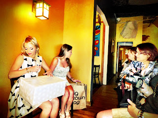
Opening gifts at the shower

Friday, September 13, 2013

NICE Fall Feel This Weekend

Fall lovers will be ecstatic about this weekend’s weather with crisp refreshing mornings, and dry pleasant afternoons. Saturday will feature a mix of sun and clouds. UCONN Huskies fans may want to bring a sweatshirt and a blanket for the game with temps dropping through the 50s. Sunday is mostly sunny. Clouds will return on Monday with the chance for a passing shower.  Most of next week looks dry and sunny. Temperatures will remain below average with no big warming trends anytime soon.

Tonight: Early sprinkle. Clearing. Low: 48-53.

Tomorrow: Partly to mostly sunny, dry and pleasant! Northwest wind 5 to 15 miles an hour.

Sunday: Chilly, refreshing start to the day. Mostly sunny, dry and pleasant. High temperatures in the low to mid 70s.

Monday: Mostly cloudy, chance for a passing shower. High temperatures near 70 degrees.

Tuedsay: Mostly sunny, a bit cooler. High temperatures in the upper 60s


Wednesday: Mostly sunny, dry and pleasant. High temperatures in the low to mid 70s.

Tuesday, September 10, 2013

Summer Is Back!

Summer heat and humidity return for a couple of days. The quick warm up will come to a halt Friday as temperatures crash back into early fall territory by this weekend.  Wednesday morning clouds and fog will break for hazy sunshine.  Temperatures will hit 90 for the first time in over a month! An isolated late day storm is possible. Thursday will remain very warm and humid with increasing clouds and a growing chance for storms through the afternoon and evening as a cold front approaches.  

Tonight: Humid, patchy fog. Low: 68-73.

Tomorrow: Hot, hazy and humid. Summer is back! South wind 5 to 15 mph. Low 90s inland. Mid to upper 80s along the shoreline. Chance for an isolated storm late.

Thursday: Warm and humid with increasing clouds. Scattered storms developing in the afternoon from west to east. Temperatures in the low to mid 80s.

Friday: Cooler and less humid. Partly to mostly sunny. High temperatures in the upper 60s and low 70s.

Saturday: Mostly sunny with a chilly fall feel! High temperatures staying in the 60s.

Sunday: A mix of sun and clouds. High temperatures in the upper 60s to near 70 degrees.

Monday, September 9, 2013

Summer Isn't Over yet!

Some people have already stashed the air conditioner units away for the season. But don’t count summer out yet!  Tuesday morning will start off cloudy with a shower possible in spots. Clouds will break for sunshine with warmer and increasingly humid air moving in throughout the day. The heat and humidity peak Wednesday.  Thermometers will hit 90 degrees for the first time since July 20th! But just for a day.  A cold front Thursday will bring a round of showers and storms and an end to the heat.   

Tonight: Increasing clouds. Low: 55-63

Tuesday: Chance for an early shower. Clouds break for some sun. Turning warmer and more humid. South wind at 10 to 20 mph.

Wednesday: Hot, hazy and humid. Summer is back!  South wind 5 to 15 mph. Upper 80s and low 90s inland. Mid to upper 80s along the shoreline.

Thursday: Very warm and humid with numerous showers and storms developing in the afternoon from west to east. High temperatures in the low to mid 80s.

Friday: Cooler and less humid. Partly to mostly sunny. High temperatures staying in the 60s!

Saturday: A mix of sun and clouds. Slight chance for a shower. High temperatures staying in the 60s.

Friday, September 6, 2013

Nice Weekend!

The weekend will start chilly and end chilly. In between, late summer weather returns. After a fall-like start Saturday, temperatures will rebound into the mid to upper 70s.  Sunshine will mix with clouds as a cold front approaches.  Showers are possible late Saturday night into Sunday morning.  Early showers will give way to clearing Sunday. The cool air will lag behind the front, arriving Sunday night into Monday. But summer isn’t over yet.  80s are likely by the middle of next week.

Tomorrow: Chilly start, milder finish. Sunshine mixing with some clouds in the afternoon. High temperatures in the mid to upper 70s. Chance for showers at night.

Sunday: Chance for a passing shower in the morning. Then clearing out. High temperatures in the mid to upper 70s. Chilly night!

Monday: A fall-like day. Partly to mostly sunny.   High temperatures in the upper 60s and low 70s.

Tuesday: Partly cloudy, a bit warmer and turning increasingly humid. High temperatures in the upper 70s to near 80 degrees.


Wednesday: Warm and humid with hazy sunshine. High temperatures in the mid 80s or warmer!

Thursday, September 5, 2013

Near Record Cold Tonight

When you wake up Friday and look out the window, the sunny view will be deceiving.  You may even find yourself running back inside to grab a light jacket! Temperatures will begin close to record lows in the 40s and low 50s. The record for Bridgeport is 48 degrees, last set in 1988.  The record for Windsor Locks is 40 degrees.  Gardeners don’t worry. I’m not concerned about an early frost in Connecticut. At least, not this time around!

By Friday afternoon, thermometers will struggle to hit the 70 degree mark. The heart of cool air will remain in place into Saturday morning.  The afternoon looks milder. A few showers are possible Saturday night into Sunday morning. But most of the weekend looks dry for late summer fairs this weekend.

Tonight: Near record cold!  Lows: 39-49.

Tomorrow: Fall feel all day with below average temperatures. Chilly morning in the 40s. Abundant sunshine. High temperatures in the upper 60s to near 70 degrees.

Saturday: Chilly start, milder finish. Sunshine mixing with some clouds late in the day. High temperatures in the mid to upper 70s. Chance showers at night.

Sunday: Chance for a passing shower in the morning. Turning a bit humid. Then slowly clearing out. High temperatures in the mid to upper 70s.

Monday: Sunny, cool. Turning less humid. High temperatures in the low 70s.

Tuesday: Partly cloudy, a bit warmer and turning increasingly humid. 80s return by the middle of next week.

Monday, September 2, 2013

One More Muggy Day Then Drier, Sunny

The unofficial last weekend of summer felt a bit like living in a tropical rainforest!  But the threat for storms and high humidity is almost over.


A flash flood watch remains in effect until 11 PM for the northern half of the state. But it appears the flood threat is over for tonight and we deserve a break from the rain!

Flash flooding earlier today in New London left 6”-8” of water on portions of route 12 from the US Naval Submarine Base south to Groton.  Also in New London, South Road at the railroad underpass was closed by police due to flooding. In Danbury, Long Ridge Road was closed due to flooding with wires down. A car was stuck in water in New Britain on Golden Hill Street with 4”-8” of water flooding several local streets.
Tonight we’ll get a little break in the action before one final round of storms tomorrow. 

A cold front will move through Connecticut midday on Tuesday.  A few storms will fire up along the front with the leading edge of drier, less humid air. After that, we are looking at a stretch of cooler days with plenty of sunshine. Another front will bring a reinforcing shot of cooler air by Friday morning with temps dropping into the 40s!

Tonight: Lingering shower or storm in spots. Humid, patchy fog.  Low: 65-70

Tomorrow: Early fog. Partly cloudy and humid with the chance for a shower or thunderstorm. Turning less humid late day and at night.

Wednesday: Mostly sunny, noticeably less humid. High temperatures near 80 degrees inland and along the shoreline. West wind 5 to 15 mph.

Thursday: A mix of sun and clouds. Chance for an isolated shower. High temperature in the mid to upper 70s. Chilly at night.

Friday: Chilly, refreshing start to the day. Abundant sunshine. Cooler than average. High temperatures in the low to mid 70s.

Saturday: Sunshine mixing with a few clouds. Turning a bit more humid. High temperatures in the upper 70s to near 80 degrees.

Instagram @RachelFrankCT