

I’m highly confident of a winter storm this weekend. The timing would be Saturday afternoon through midday Sunday with the worst part of the storm hitting overnight Saturday into Sunday morning. Plowable snow is possible for most of the state. A rain/mix is most likely with an eventual change over to wet snow. That changeover will take longer along the shoreline leading to lower snowfall totals. BUT precip amounts will be high. The storm could produce 1-2” of liquid!
What we’re working on:
Unlike the last storm (all snow), the precipitation type is not as straight forward. A rain/snow line will likely set up somewhere in New England, maybe even OVER Connecticut. I mentioned above that the storm could produce up to 1”-2” of liquid.
 |
| Precip totals by Sunday night from the European Forecast Model (ECMWF). Legend at the bottom is in inches. |
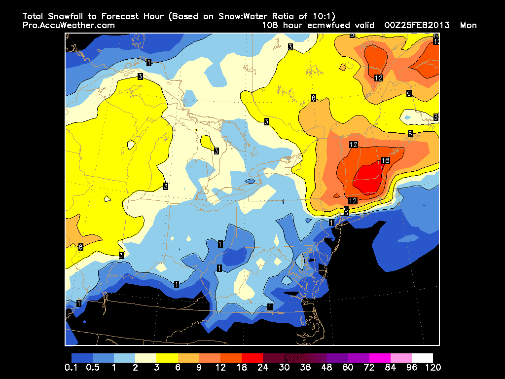 |
| Total snowfall ECMWF (based on 10:1 ratio) |
Finding the rain/snow line will hinge on these factors:
- How quickly the storm strengthens. That will depend on the interaction between this storm and another one dying out over the great lakes.
- Surface temperature (obviously).
- The storm’s track can help determine precipitation type. Most major snow storms pass over what meteorologists call “the benchmark”. This is a spot over the ocean about 100 miles southeast of Montauk Point with the coordinates 40N, 70W. A storm passing south east of this sweet spot will generally produce less snow (too far away). A storm passing northwest of this point is more likely to bring a mix to Connecticut (more mild air, ocean influence). Obviously this isn’t the case 100% of the time as there are other variables. But it gives you the general idea. Right now the European forecast model has the storm tracking “inside” the benchmark, near/over Cape Cod. But that could change as we monitor the storm the next few days.
 |
| Sunday morning on the ECMWF. Notice how close the low's center comes to CT. |
Because Connecticut will be near the rain/snow line, a heavy wet snow is a real possibility. This could cause outages as power lines and trees get coated in sludge.
3 comments:
Great Job Rachster! ;)
im ready for spring
Let's give her the WEEKEND OFF for wedding doings --
No snow this weekend Baseball practice begins in the parking lot...
Hugs
John W
Post a Comment