
Most people will see a foot to a foot and a half of snow out of this storm! No matter how much snow falls, the wind is really a bigger issue because it will blow a lot of the snow around making it nearly impossible to see with blizzard conditions and zero visibility at times.
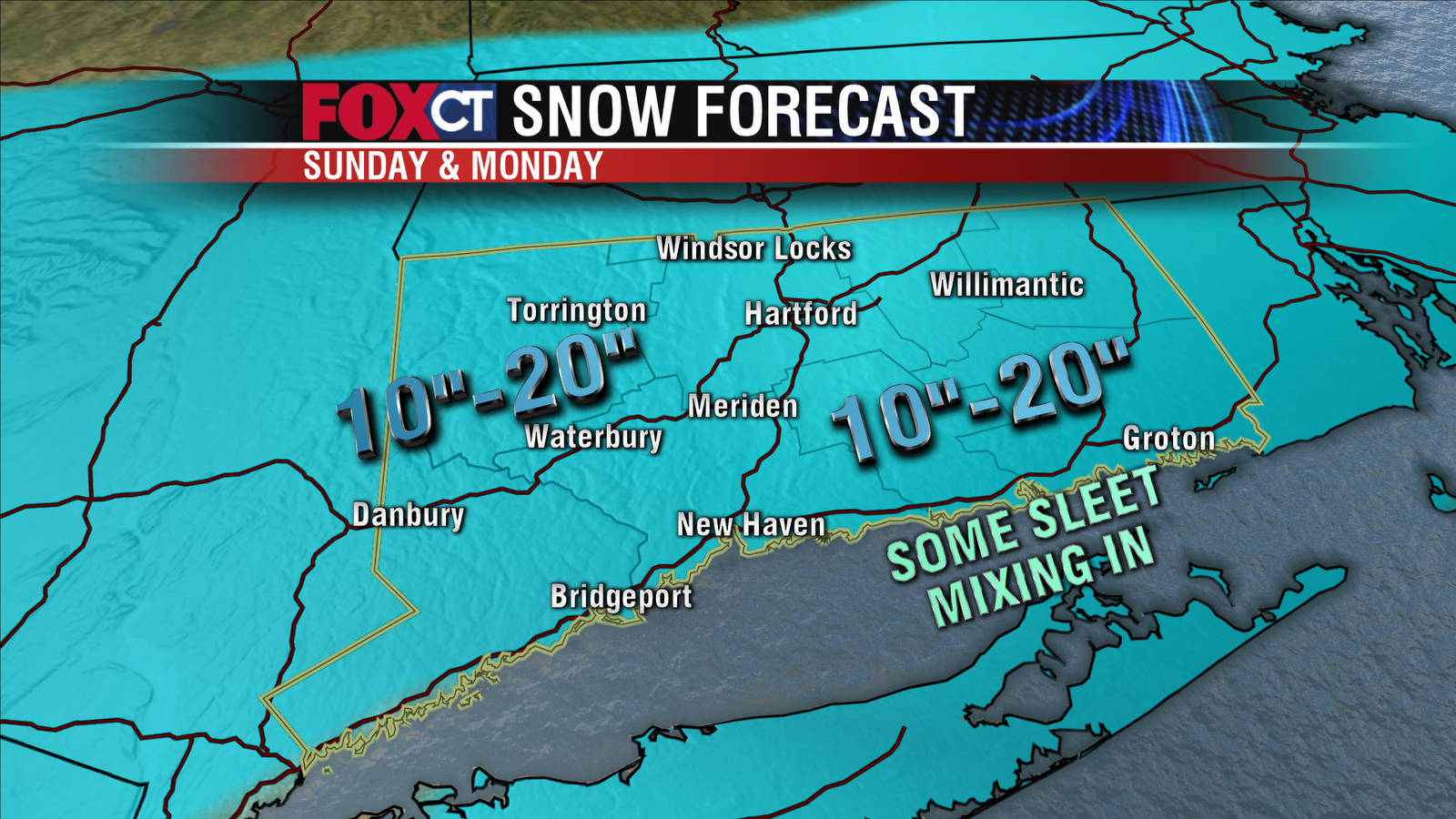
Southeastern Connecticut (New London) may see the lower end of the (10"-20") range with some sleet mixing in at times. The higher end of the totals will land where "mesoscale banding" occurs. These bands are nearly impossible to predict and are usually a few miles wide. Very heavy snow will occur in the bands, with thunder possible. Looks like they might set up in northwest CT but it's too early to tell.
Most of the snow that falls will be fluffy, powdery snow (the kind that is NOT good for making snowmen). But southeastern CT could see isolated power outages with a wetter, heavier snow.
1 comment:
very well written — thank you Rachel for the updates and great info! =)
Post a Comment