THANKS FOR VISITING!

I'm an Emmy Award Winning meteorologist at Fox 61 in Hartford. For the latest forecast updates (and fun stuff too, like food and family pics), please follow me on Facebook, twitter and instagram. I look forward to interacting with you there!

LIKE ME ON FACEBOOK!

Friday, January 22, 2016

Critical 30 Miles!

While parts of northern Connecticut will get little/no accumulation, some on the shore could get slammed with double digit snow totals. It’s a shoreline special!

Your storm cliffs notes:

Starts: Daybreak for southern Connecticut slowly overspreading the state from south to north and reaching the Massachusetts border by afternoon.
Heaviest snow: 3 pm – 10 pm
Ends: Around midnight, give or take a couple hours.
Accumulations: Little or nothing in far northern CT with up to a foot in southwestern areas
Additional Concerns: Minor coastal flooding, gusty winds, blowing and drifting of snow (low visibility)

Forecast Details:

Not only will be have snow around tomorrow, but gusty winds too! On the shoreline winds could
gust up to 40-50 miles an hour. While that’s not enough to produce widespread power outages. Scattered outages are a possibility.  Inland gusts will be up to 30-40 miles an hour. Blowing snow and reduced visibility will likely be a concern too. This isn’t a beautiful snow flakes gently falling on your head type of storm. Snow will whip you in the face.

Coastal flooding looks to be minor at this time for both high tide cycles Saturday.
There will be a big range in accumulation over a short distance. That’s one of the reasons this storm
has been so tough to forecast, and still is. Imagine the track shifts north by 30 miles. That’s the difference between 4-8” or 8-12”. A shift south would be the difference between 4”-8” and just 1”-4”. So this is a high stakes forecast. Because a 30 mile shift is the difference between a high impact event and a low impact event.

Our computer guidance is still all over the place. Some of our computer models are still suggesting over a foot of snow well inland which is a lot more than our current forecast (NAM, RPM). Other computer models are lower than our current forecast with up to 4” on the high end for the shoreline (RGEM). Now it’s a meteorologist’s job to take what the computer models say and draw their own interpretation.  This is why you will find different forecasts on different news outlets. Wish us luck! My sanity depends on it.

Tonight: Cloudy, dry. Low: 20-25.
Tomorrow: Snow in the shore around daybreak, slowly overspreading the state. High: 25-29.
Sunday: Becoming sunny. High: 34-37.
Monday: Mostly sunny, not as cold. High: Upper 30s-Near 40
Tuesday: Mostly cloudy, chance for a shower. High: Mid 40s.
Wednesday: Partly cloudy. High: Near 40. 

Thursday, January 21, 2016

We're Livin' On The Edge!

Although temperatures will be similar on Thursday, the wind will be calmer. A light wind combined with lots of sun should go a long way in making it feel more comfortable outside.

The weather remains quiet and dry all the way through Friday night. Then all eyes will be on a developing nor’easter. We have high confidence that the Mid-Atlantic will be the target for the highest snow accumulation. Parts of DC and Maryland could get 2 feet of snow or more. Here in Connecticut the impact will be less. Southern New England appears to be on the northern fringe of this storm.

Now here’s the tricky part… It appears this storm will have a sharp cut off between heavy snow and little to nothing over a short distance. 25-50 miles north or south can make a really big difference. So right now we’re not expecting a big snow storm in Connecticut. But it’s a high stakes forecast with some impressive snow totals lurking nearby!

Euro Ensembles show a 6" mean snowfall through
southern CT which is a jump north from previous runs
Snow totals will be higher farther south and west. So we expect the shoreline to have the highest snowfall totals in the state. It’s entirely possible that parts of northern Connecticut get a light dusting or a few flakes while some on the shoreline pick up half a foot or more. The gradient will be that sharp, leaving plenty of room for error.

Timing: Saturday into early Sunday morning

Impact: Plowable snow likely for many, especially in southern Connecticut. Gusty winds and minor coastal flooding are possible too.

Accumulations: A coating to a few inches for most of the state with the least snow in far northern Connecticut. Higher amounts are possible in southern areas and especially along the shoreline where up to about 6-8” is possible.

Stay with FOX 61’s weather team on air, online and in our app all week as we keep an eye on the possible storm.

Forecast Details:
Tonight: Mostly cloudy. Low: 15-20.
Thursday: Cold despite plenty of sunshine. Breezy. High: 30-35.
Friday: Increasing clouds. High: Low-30s.
Saturday: Snow & gusty winds possible. But the exact impact on a brewing nor’easter remains uncertain. High: Mid-upper 20s.
Sunday:  Any lingering snow ends early. Clouds break for some sun. High: Low 30s.

Tuesday, January 19, 2016

Mid-Atlantic Bullseye Likely. CT Impact More Uncertain.

As computer models trend farther south, the
threat for big snow diminishes here in CT.
Plowable/fringe effects/miss are all still possible.
Wednesday will remain breezy and chilly. But it won’t be AS windy or AS cold as recent days. At least the sun is on our side.

The weather remains quiet and dry all the way through Friday. Then all eyes will be on a developing nor’easter. Before you read all the details regarding this tricky forecast, I wanted to get you started with the “meat and potatoes” of what we think so far. Remember of course a lot of this will likely change (it’s only Tuesday).

Timing: Saturday morning Impact: Big spread in possibilities ranging from a significant snow storm to just fringe effects or a total miss.
Trend: The trend over the last 24-36 hours has been to keep the heaviest snow south of Connecticut, near the Mid-Atlantic.
Precipitation: All snow
Additional Threats: Gusty winds and minor coastal flooding. 

Right now the piece of energy that we’re watching is just coming onto land in the Pacific Northwest bringing rain and mountain snow there. This energetic disturbance will travel across the country, eventually joining forces with moisture from the Gulf of Mexico. Then the fun begins. As the storm exits of the coast of North Carolina it will rapidly strengthen. It’s that process that usually helps mark a bullseye for the heaviest snow. So that’s where we have the most confidence in a blockbuster storm at this time.

High confidence on a rapidly strengthening low
off the Mid-Atlantic coast. But where that storm
tracks  next is more uncertain.
But what happens next is harder to determine. Some of our computer models are still hinting at a big storm here in Connecticut (GFS) with the chance for a foot of snow and the storm tracking just southeast of Nantucket. But when forecasting, “trend is our friend”. The latest trend over the last 24-36 hours has been to move the track farther offshore, taking the heaviest snow along with it. In fact, the European model shows a near miss! Will this trend continue? Or will it reverse course? That’s one thing we’ll be looking at over the coming hours/days.

Another aspect about this set-up that makes it interesting to forecast, It appears like this storm will have a sharp cut off between heavy/crippling snow(2-3 feet) and plowable snow (a few inches). With another sharp line from plowable snow to little/nothing.

Forecast Details: 

Tonight: Winds diminish a bit. But remaining breezy. Low: 12-18.
Wednesday: Mostly sunny, not as cold but still a bit breezy at times. High: 30-35.
Thursday: Cold despite plenty of sunshine. Breezy. High: 30-35.
Friday: Increasing clouds. High: Low-30s.
Saturday: Snow & gusty winds possible. But the exact impact on a brewing nor’easter remains uncertain. High: Mid-upper 20s.

The latest run of the GEFS showing the wide spread in
possible solutions from a big storm to nothing!
Image: Weatherbell

Snow?! So you're sayin' there's a chance! FINALLY!

All of the models show a beast of a no'reaster. But where it
tracks and the speed is more uncertain. (Image by WxBell)
On Saturday we have the first real chance for significant snow this winter! A brewing nor’easter will bring the threat for a high impact storm from Washington DC all the way through New England. 

As of right now a plowable snow is becoming more likely. We also have decent confidence that this storm will produce the most snow of the season to date (which is easy because we haven’t seen much). But whether you’re rooting for an epic storm or hoping for a miss, there is too much uncertainty to get excited or nervous about this storm yet.

While there’s still a lot we don’t know, it’s actually REALLY impressive that all of our computer models agree 1) an impressive beast of a nor’easter will develop AND 2) said nor’easter will threaten the East coast.  When that happens, our forecast confidence grows.  But the storm’s ultimate track and speed is still a question mark. How much the low deepens and where it travels will be vital clues in determining the impact here in Connecticut.  While a big snow storm is still on the table for us, there’s still a good chance the heaviest snow misses to our south. (See BULLSEYE)

TIMING: All week looks dry, right up through Friday. Right now the most likely start time of this storm would be late Friday/predawn Saturday morning. The storm could last all the way into early Sunday morning.

The probability of over 1" of precipitation. Check out
that bullseye over the Mid-Atlantic.  (Image by WxBell)
BULLSEYE: If I had to guess who would get the worst of this upcoming storm, it appears the Mid-Atlantic area from Virginia/West Virginia to Washington DC will be under the gun for some of the heaviest snows.  That’s where the storm will rapidly drop in pressure or ”bomb” out.

WHERE IS IT NOW: The storm we’re watching is still out in the Pacific Ocean, moving from Alaska towards the Pacific northwest. It’s important to note, computer models work by taking a combination of weather observations and satellite data to get a picture of what’s going on in the atmosphere. But observations from buoys are more sparse than weather stations on land.  While computer models will attempt to fill in the gaps, it’s not always perfect.  We call this poor sampling.  And my teacher in Meteo 201 used to say “garbage in, garbage out”.  If the data used to feed computer models is wrong (or unavailable) the resulting forecast will be wrong. Errors amplify with time. This is one of the reasons why we send airplanes into hurricanes to gather data.   Until this storm moves over land (and that will not happen until Friday) the forecast is less reliable.

A variety of different solutions even when looking at
the same computer model. Bottom line, the impact in CT is not
set in stone yet.  (Image by WxBell)


It’s 2:20 AM Tuesday. I can’t think anymore. Hope this was interesting/helpful to you!

Wednesday, January 13, 2016

Less Wind Tomorrow, Rain Likely This Weekend

WINDS DIMINISH TONIGHT-THURSDAY

After a blustery day with wind gusts exceeding 45 mph, the wind will slowly diminish tonight. While the "wind chill" will not be much of a factor Thursday morning, it will still be cold at the bus stop with temps beginning in the 10s and 20s.


MORE COMFORTABLE FRIDAY

Temperatures will rebound on Friday, climbing into the 40s in the afternoon with increasing clouds. Those milder temperatures will set the stage for our next storm. Hint, hint.

RAIN LIKELY SATURDAY

A storm Friday night into Saturday is taking a track that is typically favorable for snow here in Connecticut. But confidence is growing in a rain event. It looks like we're lacking enough cold air for powder. While a storm strengthens close to the "benchmark" for winter weather, there is no cold "blocking high" to the north to help lock in the cold.  This storm is still worth watching. It is January in New England, after all!

MAYBE SNOW LATE SUNDAY?

Some of our computer models are hinting at an offshore storm that could bring some light snow to the area late Sunday.  But there is poor model consensus regarding this. Either way it doesn't look like a significant event for us and there's still a good chance it will totally miss!

Forecast Details:

Tonight
: Partly cloudy, increasing clouds late. Low: 15-20.

Tomorrow: Cloudy start with the chance for flurries or a snow shower. Turning partly cloudy. High: 30-35.

Friday: Partly cloudy with increasing clouds late. High: 40-45.

Saturday: Rain likely, mainly in the morning. High: 40-45.

Sunday: Mostly cloudy, slight chance for snow late-day and at night. High: Mid 30s.

Monday
: Partly cloudy, colder and breezy. High: Mid 20s.

Tuesday, January 12, 2016

Snow Replaced By Cold & Wind

While most of the state saw a quick coating of snow, some of the hill towns in northern Connecticut picked up a quick inch or two of snow. Closer to the shoreline, it was a rain/snow mix or even just rain!

A few lingering snow showers are possible before 1-2 AM. Otherwise, the big story is the cold and wind that follows!


COLD AND WINDY WEDNESDAY

Wednesday will be cold and windy in the wake of today’s little storm. High temperatures will only be in the 20s but it will feel more like the teens and single digits when you factor in the wind. Gusts could reach up to 45+ mph. A Wind Advisory is in effect Tuesday night into Wednesday. The National Weather Service warns that isolated power outages are possible. There is also a chance for a few lingering flurries.

WEEKEND STORM POSSIBLE

Looking ahead towards the weekend there is a more impressive storm on the horizon for Friday night into Saturday. That storm is taking a track that is typically favorable for snow here in Connecticut. But it looks like we're lacking enough cold air for powder. With a temperature profile that is borderline Saturday, our best call is to have you prepare for a wintry mix or rain. We’ll continue to watch the latest trends though as we get a little closer. Snow will be close by!

Forecast Details:

Tonight: Chance for a lingering snow shower early. Becoming windy. Low: 20s.

Wednesday: Partly cloudy, windy and cold. Chance for flurries in spots. Wind chills in the 10s. High: 25-30.

Thursday: Partly cloudy, less wind but remaining chilly. High: 27-33.

Friday: Mostly sunny, not as cold as recent days. High: 38-43.

Saturday: Rain, which may start off as a brief wintry mix in spots. High: Near 40.

Sunday: Mostly cloudy, chance for a snow shower. High: 30s.

Friday, January 8, 2016

Saturday "Better" Than Sunday


Untreated surfaces could be slippery early Saturday morning with areas of mist and temperatures near freezing.

The rest of the day looks cloudy and damp. However dreary, Saturday is the pick of the weekend!

Sunday looks like a washout with gusty winds and periods of rain, some heavy. While you will need an umbrella, you won’t need a winter coat. Temperatures Sunday will likely break records, soaring through the 50s. With gusty winds, isolated power outages are possible on Sunday. Winter cold returns Monday with highs in the 20s and 30s for most of next week.

There is a chance for snow Tuesday night into Wednesday morning. But it looks like the ingredients for a big storm will not come together for us here in Connecticut just yet!

Wednesday, January 6, 2016

From Ice To Rain & Record Warmth

ONE MORE DAY OF SUN

Soak up the blue skies and sunshine on Thursday. Clouds return Friday with an easterly wind bringing in moisture off the ocean. Some drizzle is possible late in the day.

ICY SPOTS FRIDAY NIGHT – SATURDAY MORNING

Mist, combined with temperatures dropping below freezing, could lead to some icy spots Friday night into Saturday morning. Most of Saturday looks dry yet cloudy with the chance for a passing shower.

HEAVY RAIN AND RECORD WARMTH SUNDAY

Sunday is the warmer and wetter half of the weekend with periods of rain (some heavy). Record challenging warmth is possible too with highs in the 50s. Around an inch of rain is likely with higher amounts possible too.

COLDER NEXT WEEK, SOME SNOW?

Colder air will return behind Sunday’s storm.  There is even a chance for some snow in the forecast Tuesday night into Wednesday with the possibility for a little light accumulation. But that’s still 6-7 days out.

Forecast Details:

Tonight: Clear, cold. Low: 10-20.

Tomorrow: Sunny, a bit milder. High: 40-45.

Friday: Becoming cloudy with the chance for drizzle developing late. Some icy spots possible at night as temperatures drop below freezing. High: 37-42.

Saturday: Chance for icy spots early with areas of freezing drizzle. Otherwise, cloudy with the chance for a shower or two. High: 37-42.

Sunday: Mild and wet with periods of rain, some heavy. Record challenging warmth. High: 50-55.

Monday: Clouds break for sunshine. High: Near 40.

Friday, January 1, 2016

Stellar Winter Weekend (Excluding Skiers)

A TOUCH OF SNOW TO START 2016

No, that’s not leftover confetti! There are a few flurries scattered about parts of the state tonight. Some towns have even seem a brief coating
of snow on top of cars or back decks (nothing sticking to the roads). Snow showers will be hit-or-miss through early tonight, followed by some clearing.

COMFY THIS WEEKEND, BITTER COLD START TO THE WORK-WEEK

The coldest air of the season is heading this way! The arctic blast arrives Monday which means kids heading back to school will need to bundle up in full winter gear: hats scarves and gloves. Meanwhile, this weekend looks great for outdoor plans. Temperatures will be around (or a bit above) average with a fair amount of sunshine. High temperatures Monday and Tuesday will only be in the twenties with low temperatures in the teens and single digits. Cold, yes. But still no big storms in sight.

Tonight: Chance for flurries or a brief snow shower. Low: 25-30.

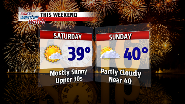
Saturday: Mostly sunny. High: Upper 30s.

Sunday: Partly cloudy. High: Near 40.

Monday: Cold despite plenty of sunshine. High: 20s

Tuesday: Windy and cold. High: 20s.

Wednesday: Sunny, not as cold as recent days. High: mid-upper 30s.

Thursday, December 31, 2015

HAPPY NEW YEAR!


THE WEATHER COOPERATES FOR NEW YEARS EVE PLANS!

Thankfully, the fog from this morning has lifted and the weather is cooperating for fireworks and festivities. If you’re heading out to celebrate New Year’s Eve, dress for temperatures in the 30s around the time of the ball drop.

YEAR IN REVIEW
2015 weather year in review! PLUS...I had a stare down with a cat. And the cat won.
Posted by Meteorologist Rachel Frank on Thursday, December 31, 2015


2015 was a wild ride. This December will go down as the warmest on record by a large margin. But do you remember February? Not only was it the coldest February on record, but it was the coldest month ever recorded in Connecticut. After a snowy start to the year, 2015 ended on a dry note, 6-7” below average for Windsor Locks and Bridgeport with a moderate drought statewide. So what’s in store to start off 2016?

Party animals!
WINTER COLD BUT NO SNOW FOR SKIIERS

Looking ahead, we have a real dose of winter cold lined up for early next week. On Monday and/or Tuessday high temperatures will only be in the 20s with lows in the 10s and even single digits for some of the coolest spots. BUT still no snow for the skiers and snowboarders outside of the chance for a few flurries here or there.

From everyone here on the FOX61 Weather Watch team, have a very Happy New Year! Thank you so much for your support and trust.

Forecast Details:

Tonight: Partly cloudy. Midnight Temp: 30-35. Low: 27-32

Friday: Partly cloudy. Slight chance for a late day snow shower or flurry, mainly in northern Connecticut. High: Low 40s.

Saturday: Mostly sunny. High: Upper 30s.

Sunday: Partly cloudy. High: Near 40.

Monday: Cold despite plenty of sunshine. High: 27-32.

Tuesday: Windy and cold. High: 20s.

Instagram @RachelFrankCT