
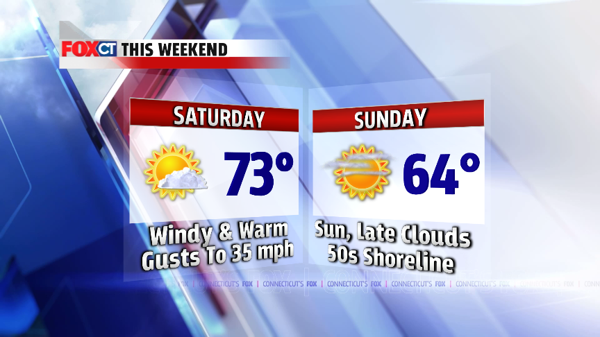
 There is an enhanced risk for brush fires on Saturday with a
combination of gusty winds and low humidity. Other than that, Saturday will
also be a great day to spend outside. Temperatures
will soar through the 70s and sunshine will mix with a few afternoon clouds. A
cold front will come through in the afternoon. Rain will most likely stay north
of Connecticut although there is a chance for an isolated shower. Sunday will
be noticeably cooler with high temperatures in the 60s inland, 50s for the
shoreline. Wet weather returns late Monday with a coastal storm. Rain could
come down heavy at times Monday night into Tuesday. Cooler, unsettled weather sticks around for
most of next week.
There is an enhanced risk for brush fires on Saturday with a
combination of gusty winds and low humidity. Other than that, Saturday will
also be a great day to spend outside. Temperatures
will soar through the 70s and sunshine will mix with a few afternoon clouds. A
cold front will come through in the afternoon. Rain will most likely stay north
of Connecticut although there is a chance for an isolated shower. Sunday will
be noticeably cooler with high temperatures in the 60s inland, 50s for the
shoreline. Wet weather returns late Monday with a coastal storm. Rain could
come down heavy at times Monday night into Tuesday. Cooler, unsettled weather sticks around for
most of next week.
Tonight:
Clearing. Low: 45-50.
 A FIRE WEATHER WATCH
IS IN EFFECT SATURDAY. THAT MEANS A
HIGHER RISK OF BRUSH FIRES TO FORM AND SPREAD WITH A COMBINATION OF DRY AIR,
MILD TEMPS AND GUSTY WINDS.
A FIRE WEATHER WATCH
IS IN EFFECT SATURDAY. THAT MEANS A
HIGHER RISK OF BRUSH FIRES TO FORM AND SPREAD WITH A COMBINATION OF DRY AIR,
MILD TEMPS AND GUSTY WINDS.
Tomorrow: Windy
and warm. A gusty northwest wind at 10-20 mph. Higher gusts up to 35 mph. High:
68-75.
Sunday: Sunshine
mixing with late day clouds. Cooler. High: 60-65 inland, 55-60 for the
shoreline.
Monday: Rain developing, some heavy at times late Monday or Monday night. Cooler. High: 48-53.
Tuesday: Chance
for some lingering morning showers. Clouds break for some late day sunshine.
High: 60-65.
Wednesday: A mix of
clouds and sun, cooler. High: 54-58.
No comments:
Post a Comment