
As the storm strengthens, winds will pick up, gusting to 30 mph at times. Winds will blow out of the northeast (hence the name nor’easter). The storm will pass just over or east of Cape Cod Friday morning. Many areas will still deal with leftover rain or snow showers on their way to work/school. Although most roads will be wet for the commute, there will be some slick spots, especially in the higher elevations. The heaviest precipitation will move out during the morning, leaving a few lingering rain or snow showers during the afternoon. Clouds will diminish tomorrow night with a partly sunny, dry and breezy weekend on the way.

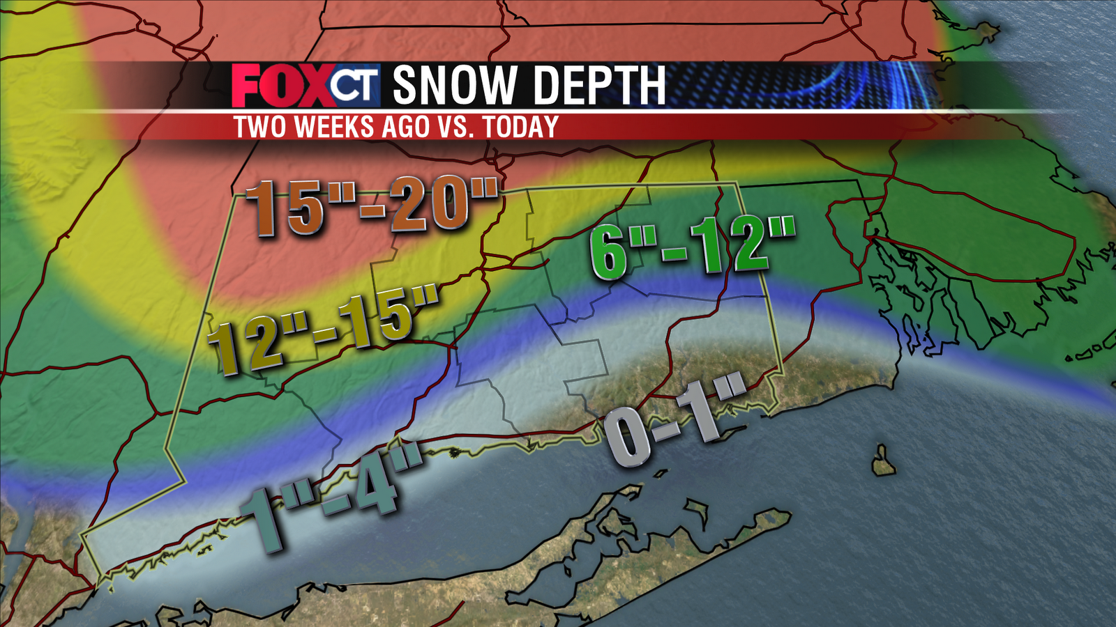
Snowfall accumulations will range from a slushy coating to an inch along the shore and in southeastern Connecticut. Northern Litchfield, Hartford and Tolland Counties will get 4”-8” with the rest of the state in the 1”-4” range. The higher end of the range will be reserved for the higher elevations and for cities and towns north of I-84.


