THANKS FOR VISITING!

I'm an Emmy Award Winning meteorologist at Fox 61 in Hartford. For the latest forecast updates (and fun stuff too, like food and family pics), please follow me on Facebook, twitter and instagram. I look forward to interacting with you there!

LIKE ME ON FACEBOOK!

Friday, January 8, 2016

Saturday "Better" Than Sunday


Untreated surfaces could be slippery early Saturday morning with areas of mist and temperatures near freezing.

The rest of the day looks cloudy and damp. However dreary, Saturday is the pick of the weekend!

Sunday looks like a washout with gusty winds and periods of rain, some heavy. While you will need an umbrella, you won’t need a winter coat. Temperatures Sunday will likely break records, soaring through the 50s. With gusty winds, isolated power outages are possible on Sunday. Winter cold returns Monday with highs in the 20s and 30s for most of next week.

There is a chance for snow Tuesday night into Wednesday morning. But it looks like the ingredients for a big storm will not come together for us here in Connecticut just yet!
Wednesday, January 6, 2016

From Ice To Rain & Record Warmth

ONE MORE DAY OF SUN

Soak up the blue skies and sunshine on Thursday. Clouds return Friday with an easterly wind bringing in moisture off the ocean. Some drizzle is possible late in the day.

ICY SPOTS FRIDAY NIGHT – SATURDAY MORNING

Mist, combined with temperatures dropping below freezing, could lead to some icy spots Friday night into Saturday morning. Most of Saturday looks dry yet cloudy with the chance for a passing shower.

HEAVY RAIN AND RECORD WARMTH SUNDAY

Sunday is the warmer and wetter half of the weekend with periods of rain (some heavy). Record challenging warmth is possible too with highs in the 50s. Around an inch of rain is likely with higher amounts possible too.

COLDER NEXT WEEK, SOME SNOW?

Colder air will return behind Sunday’s storm.  There is even a chance for some snow in the forecast Tuesday night into Wednesday with the possibility for a little light accumulation. But that’s still 6-7 days out.

Forecast Details:

Tonight: Clear, cold. Low: 10-20.

Tomorrow: Sunny, a bit milder. High: 40-45.

Friday: Becoming cloudy with the chance for drizzle developing late. Some icy spots possible at night as temperatures drop below freezing. High: 37-42.

Saturday: Chance for icy spots early with areas of freezing drizzle. Otherwise, cloudy with the chance for a shower or two. High: 37-42.

Sunday: Mild and wet with periods of rain, some heavy. Record challenging warmth. High: 50-55.

Monday: Clouds break for sunshine. High: Near 40.

Friday, January 1, 2016

Stellar Winter Weekend (Excluding Skiers)

A TOUCH OF SNOW TO START 2016

No, that’s not leftover confetti! There are a few flurries scattered about parts of the state tonight. Some towns have even seem a brief coating
of snow on top of cars or back decks (nothing sticking to the roads). Snow showers will be hit-or-miss through early tonight, followed by some clearing.

COMFY THIS WEEKEND, BITTER COLD START TO THE WORK-WEEK

The coldest air of the season is heading this way! The arctic blast arrives Monday which means kids heading back to school will need to bundle up in full winter gear: hats scarves and gloves. Meanwhile, this weekend looks great for outdoor plans. Temperatures will be around (or a bit above) average with a fair amount of sunshine. High temperatures Monday and Tuesday will only be in the twenties with low temperatures in the teens and single digits. Cold, yes. But still no big storms in sight.

Tonight: Chance for flurries or a brief snow shower. Low: 25-30.

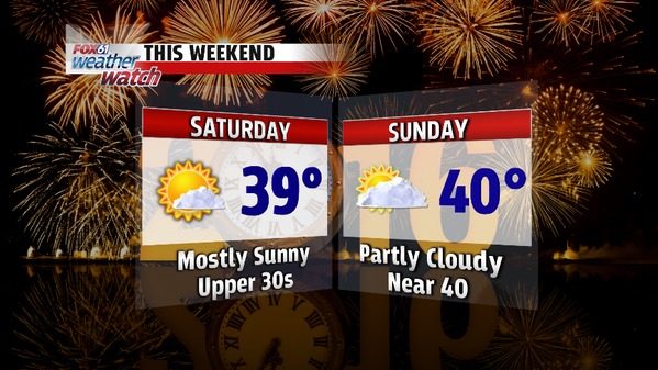
Saturday: Mostly sunny. High: Upper 30s.

Sunday: Partly cloudy. High: Near 40.

Monday: Cold despite plenty of sunshine. High: 20s

Tuesday: Windy and cold. High: 20s.

Wednesday: Sunny, not as cold as recent days. High: mid-upper 30s.

Thursday, December 31, 2015

HAPPY NEW YEAR!


THE WEATHER COOPERATES FOR NEW YEARS EVE PLANS!

Thankfully, the fog from this morning has lifted and the weather is cooperating for fireworks and festivities. If you’re heading out to celebrate New Year’s Eve, dress for temperatures in the 30s around the time of the ball drop.

YEAR IN REVIEW
2015 weather year in review! PLUS...I had a stare down with a cat. And the cat won.
Posted by Meteorologist Rachel Frank on Thursday, December 31, 2015


2015 was a wild ride. This December will go down as the warmest on record by a large margin. But do you remember February? Not only was it the coldest February on record, but it was the coldest month ever recorded in Connecticut. After a snowy start to the year, 2015 ended on a dry note, 6-7” below average for Windsor Locks and Bridgeport with a moderate drought statewide. So what’s in store to start off 2016?

Party animals!
WINTER COLD BUT NO SNOW FOR SKIIERS

Looking ahead, we have a real dose of winter cold lined up for early next week. On Monday and/or Tuessday high temperatures will only be in the 20s with lows in the 10s and even single digits for some of the coolest spots. BUT still no snow for the skiers and snowboarders outside of the chance for a few flurries here or there.

From everyone here on the FOX61 Weather Watch team, have a very Happy New Year! Thank you so much for your support and trust.

Forecast Details:

Tonight: Partly cloudy. Midnight Temp: 30-35. Low: 27-32

Friday: Partly cloudy. Slight chance for a late day snow shower or flurry, mainly in northern Connecticut. High: Low 40s.

Saturday: Mostly sunny. High: Upper 30s.

Sunday: Partly cloudy. High: Near 40.

Monday: Cold despite plenty of sunshine. High: 27-32.

Tuesday: Windy and cold. High: 20s.

Wednesday, December 30, 2015

Mild End To 2015, Some Winter Cold in 2016


ICY SPOTS IN THE HILLS TONIGHT

Most of the state is safe from ice concerns tonight. But temperatures in parts northern Connecticut are still around or below freezing. With areas of drizzle and mist, a fine layer of ice can get deposited on trees and surfaces. Treated roads should be fine for the most part. The big concern is really untreated side streets, your front steps, back deck…etc. Temperatures are expected to hold steady and even slowly rise towards daybreak. Hopefully (it will be a close call), temperatures will climb above freezing when steadier rain arrives later tonight, towards 11 PM – 1AM.

MILDER FOR NEW YEARS EVE!


This December will go down as the warmest on record by a landslide! Temperatures were an impressive 10+ degrees above average for the month. So it makes sense that the last day of the month (and year) should also be above average. With high temperatures in the 40s and developing sunshine, we will be able to melt away some of the leftover ice from our first winter storm. If you’re heading out to celebrate New Year’s Eve, dress for temperatures in the 30s around the time of the ball drop.

WINTER COLD BUT NO SNOW FOR SKIIERS

Looking ahead, we have a real dose of winter cold lined up for early next week. On Monday high temperatures will only be in the 20s with lows in the 10s and even single digits for some of the coolest spots. BUT still no snow for the skiers and snowboarders outside of the chance for a few flurries here or there.

Forecast Details:

Tonight: Icy spots hills. Areas of dense fog and mist with steadier rain developing. Low: 30s. Temps will hold steady or even rise towards daybreak.

Thursday: Clouds break for some sun. High: 45-48.

Friday: Partly cloudy. Slight chance for an afternoon flurry. High: Low 40s.

Saturday: Mostly sunny. High: Upper 30s.

Sunday: Partly cloudy. High: Near 40.

Monday: Cold despite plenty of sunshine. High: 25-30.

Tuesday, December 15, 2015

Cooler But Not Cold!

These days record warmth is so common, NOT breaking a record may garner more attention. The next few days will “cooler”. But while temperatures will stay below record territory, they will still remain well above average for this time of year. Wednesday looks calm with plenty of sunshine. Clouds and rain return Thursday with the steadiest and heaviest arriving in the afternoon and evening.  A real taste of winter cold arrives this weekend with some towns struggling in the 30s for high temperatures. We may even see a few snowflakes flying through the air this weekend. But the long range models suggest the cool-down is short-lived with 50s & 60s approaching Christmas. Our chances of a white Christmas are looking bleak!

Forecast Details:

Tonight: Gradual clearing with the wind slowly diminishing too. Low: 35-40.

Tomorrow: Mostly sunny. Still mild for early-mid December! High: 45-50.

Thursday: Cloudy with morning drizzle giving way to more numerous showers in the afternoon and evening. Patchy fog. High: 50-55.

Friday: Mostly cloudy. High: Near 50.

Saturday: Partly cloudy, windy and colder. Chance for a few flurries. High: Upper 30s-low 40s.

Sunday: Sunny, seasonable. High: Low 40s.

Friday, November 27, 2015

Sunday wins the "pick of the weekend" award

Record Warmth was recorded this Black Friday! The Hartford area set a new high temperature record of 67 degrees. That beats the old record of 64 set back in 1976.  It was close for Bridgeport with a high temperature of 60 degrees. But the old record still stands at 62 set in 1999 and 2013.

But this was just a one day warm-up! Temperatures will begin a downward slide this weekend. Sunday is the better of the two weekend days which is great for people traveling home after Thanksgiving weekend.  Saturday will not be a total wash-out. But we’re looking at mainly overcast skies and the chance for a few showers or even a period of light rain. Monday will be the coolest over the next week or so with some towns struggling to hit 40 degrees! Rain moves back in Tuesday and Wednesday.

Forecast Details:

Tonight: Increasing clouds, mild. Low: 45-50.

Tomorrow: Cloudy with the chance for a few showers or a period of light rain. High: 50-55.

Sunday: Becoming mostly sunny.  Cooler than recent days. High: 45-50.

Monday: Cooler despite lots of sunshine. High: 39-43.

Tuesday: Increasing clouds. Becoming cloudy with showers developing in the afternoon. High: 45-50.

Wednesday: Periods of rain likely. High: 50-55.

Friday, October 30, 2015

Have A Spooktacular Halloween!

New Englanders are a little wary around Halloween. Festivities were postponed or canceled for many in 2011 (October nor’easter) and 2012 (Hurricane Sandy). Luckily, there’s nothing spooky about the forecast this year! Sunshine will blend with some high clouds in the afternoon on Saturday with highs in the mid-upper 50s. For sunset Trick-or-treaters, temperatures will start near 50 degrees before falling through the 40s.

You get an extra hour of sleep Sunday morning (horray) as we “fall back” one hour Sunday at 2AM. Sunday will start off cloudy with a slight chance for a sprinkle. Then clouds will break for some sun with highs in the lower 60s. Sunday is the start of a slow warming trend that will continue through the end of next week accompanied by a long dry stretch of weather.

Forecast Details:

Tonight: Clear, frosty. Low: 28-35.

Tomorrow: Happy Halloween! Sunshine mixing with some high clouds in the afternoon. High: 53-56.

Sunday: Fall back! Daylight Saving Time ends 2 AM. Clouds break for some sunshine, milder. High: 59-62.

Monday: Mostly sunny, milder. High: 60-65.

Tuesday: Sunny, mild. High: 65-70.


Wednesday: Sunny, mild. High: 64-68.

Tuesday, October 20, 2015

CT Children's Storybook Gala


I love this so much!! Reading to Andon to support a great cause! Andon has had a few minor procedures/tests at CCMC and my husband spent months there as a child. Happy to give back and this spot turned out so cute in the process. I'm going to watch it over and over again for many years to come.

To learn more about the Storybook Gala for Connecticut Children's Medical Center click here.

Thursday, October 8, 2015

Humid, Showers Tomorrow


There could be a sneaky thunderstorm with gusty (maybe even damaging winds) tomorrow. It's a fairly low probability but the threat isn't zero. So just keep an eye on the weather. Good news, we dry out just in time for the weekend!

Tonight: Becoming mostly cloudy. Low: 50-55.

Tomorrow: Becoming mostly cloudy and breezy with scattered showers. Warmer and a bit more humid with an isolated thunderstorm possible in the afternoon. High: 70-74.

Saturday: Early clouds break for sunshine. Cooler. High: 60-65.

Sunday: Mostly sunny. High: 65-68.

Monday: Mostly sunny, warmer. High: 70-73.

Tuesday: A mix of sun and clouds, chance for a shower or two. High: 67-70.

Instagram @RachelFrankCT